





(E 12 – GR 92) Rosas – Cadaqués
Panoramic view of the bay of Roses and the surrounding area, the beaches and the creeks of the Cap de Creus natural park up to the bay of Cadaqués
A path that runs alongside an urban promenade, connected by a footbridge, passing by beaches and coves of the Cap de Creus Natural Park up to the Joncols cove, from where the path turns inland towards Cadaqués
From the Roses Tourist Office, located right next to the majestic Roses Citadel, follow the seaside promenade towards Puig Rom.
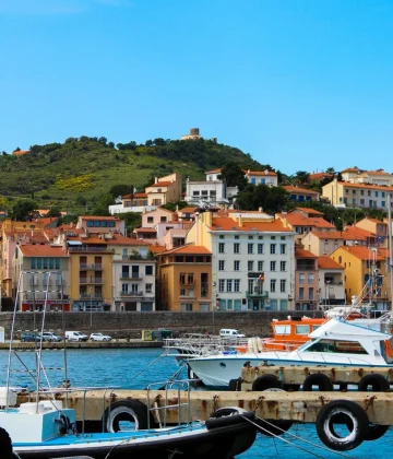
Pass the marina and, on arriving at the fishing port, look up to see the remains of the XNUMXth century Trinity Castle.
At the Roses lighthouse, leave the sidewalk and go down to the right onto the lighthouse access esplanade. The route follows the coast between left buildings and very interesting geological formations, with the bay of roses as a companion.
Pass by Canyelles beach, cross it and follow the walkway leading to Bonifacio beach and to the end of Almadraba beach.
Leave Almadraba beach and climb the stairs leading to Diaz Pachero Avenue. Here, turn right and continue for approximately 100 meters until the intersection with Rue Gauguin which goes uphill. About 100 meters away, there is a street on the right, partially asphalted, which leads to the access to the Cap de Creus Natural Park. You can see a sign indicating the park with the red and white markings of the GR
Then leave the street and take the coastal path that runs along the coast above the cliffs and offers a spectacular view of the bay of Roses.
Arrive at the area of Punta Falconera, viewpoint and vigilance of maritime traffic of the Spanish army (1944-1993), where they built a coastal battery.
Follow the path passing above Cala LLedo, an old marble quarry. The path is hilly taking the coves of Murtra, Rostella, Calis and Cala Monjoi. Here in Cala Montjoi you can see the adequacy works of the Bulli Foundation, in the place where the famous El Bulli restaurant was located
Cross the beach and take the track, where vehicles circulate, for a few meters until you reach Punta de la Ferrera, where you have to leave the track and take the path, located closer to the sea.
Cross Cala Calitjas and Cala Pelosa, site where a prison camp was located during the Spanish Civil War. Here the road climbs and crosses Cap Nordeu, an integral reserve of the Cap de Creus Natural Park.
Cross the track again to go down the path, leaving Cala Canadell at the bottom right and continue on the path which goes inland to Cala Joncols.
From there, the path is completely interior. As you advance, you can observe, at the top right, the Mas de Sa Sala and, in the distance, the area of the cliffs of Punta Prima.
Cross the Mas d'en Bastre (restored farm with some dry stone buildings) following the track. Soon we begin to glimpse the bay of Cadaquès and the easternmost part of Cap de Creus
Follow the track which leads to the entrance of the old Rocamar hotel. From there, follow the maritime promenade to the Casino, the epicenter of the cultural and social life of this fishing village. Just behind you is the Cadaquès tourist office. End of the route.